
4x4 TRAILS & STORIES CAMP SYNCRO PHOTOS SYNCRONAUTS RESOURCES
Here's some of the resources used to plan Syncro Safari, Colorado '04.
|
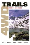
Title: 4WD Trails: Southwest Colorado
Item: Book Author: Peter Massey & Jeanne Wilson Publisher: Swagman Publishing, Inc. www.4wdbooks.com ISBN: 0-9665675-4-4 Copyright 1999 Pages: 129 Type: Paperback with B&W photos Includes: 31 trails with turn-by-turn directions to run the trail in either direction |
 |
|
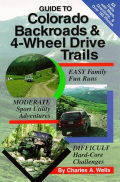
Title: Guide to Colorado Backroads & 4-Wheel Drive Trails
Item: Book Author: Charles A. Wells Publisher: FunTreks, Inc. ISBN: 0-9664976-0-0 Copyright 1998 Pages: 248 Type: Paperback with B&W photos Includes: 65 trails with decent maps |
 |
|
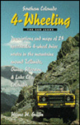
Title: Southern Colorado 4-Wheeling, The San Juans
Item: Book Author: Wayne W. Griffin Publisher: WHO Press ISBN: 1-882426-07-X Copyright 1998 Pages: 76 Type: Paperback with B&W photos Includes: 25 trails with basic trail information |
 |
|
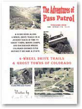
Title: The Adventures of the Pass Patrol, Volume Three
4-Wheel Drive Roads & Ghost Towns of the San Juans Item: Book (sort of "hobbyist" published with "copy shop" binding) Author: Larry E. Heck Publisher: Outback Publications Inc. ISBN: 1878261-134 Copyright 1995, revised 1998 Pages: 102 Type: Paperback with B&W photos. A "homespun" publication from the Pass Patrol 4x4 Club. Very interesting guide with amusing stories, sketches, and even a few advertisements. Good route directions. Definitely written by someone intimate to the area. Includes: 25 trails with basic trail information |
 |
|
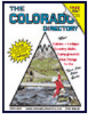
Title: The Colorado Directory, 2002-2003, 23rd Annual Cabins, Lodges, Country B&Bs, Campgrounds, Fun Things to Do
Item: Guide / Directory Author: www.colorado-directory.com Pages: 55 Type: Stapled with B&W photos Includes: Listing of lots of "adventure stuff", campgrounds, and accommodations |
 |
|
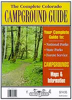
Title: The Complete Colorado Campground Guide
Item: Book Editor: Jack O. Olofson Publisher: Outdoor Books & Maps ISBN: 0-930657-23-3 Copyright 1992, revised 2001 Pages: 160 Type: Paperback guide with maps Includes: Mostly government campground, no photos, far from complete despite what the title says. Has not been of any help for this event. |
 |
|
Title: Alpine Loop Scenic Backcountry Byway Pocket Guide to the San Juan Mountains 4x4 Scenic Route
Item: Map-booklet Author: Brian & Kitty Benzar Publisher: Backcountry Travelers, Inc. ISBN: 1-928759-04-1 Copyright ???? Pages: 31 Type: Tiny shirt pocket paperback, no photos, but a really cool little guide Includes: About 4 trails contained in the region between Silverton, Ouray, and Lake City |
 |
|
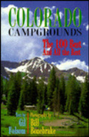
Title: Colorado Campgrounds, The 100 Best and All the Rest
Item: Book Author: Gil Folsom Publisher: Westcliffe Publishers ISBN: 1-56579-334-X Copyright 2000 Pages: 294 Type: Paperback with great color photos Includes: Gobs of campgrounds divided by region, great color photos, good information, quite complete. |
 |
|
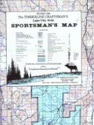
Title: The Timberline Craftsman's Lake City Area SPORTSMAN"S MAP
Item: Map Publisher: The Timberline Craftsman, Lake City, CO Copyright 1988, revised 1995 Pages: 1, single sided map, about 36" x 40" Type: Printed on "plastic paper" for great durability, about 5 colors Includes: Area including Montrose, Ridgway, Ouray, Telluride, Silverton, Purgatory, Lake City & Creede. A pretty cool large scale map. |
 |
|
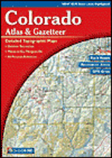
Title: Colorado Atlas & Gazetteer
Item: Atlas & Guide Publisher: DeLorme ISBN: 0-89933-288-9 Copyright 2000 (5th Edition) Pages: 104 Type: Large format atlas. 91 pages cover the entire state Includes: Index of place names, list of about 150 campgrounds, Info on National Forests / Parks / Recreation Areas, Info on BLM Lands, Info on State Parks / Recreation Areas, unique Natural Features, Ski Areas, Peaks over 14,000 ft (14ers), paved Mountain Passes, Scenic Drives, Biking info, River Trips, Hiking info, Fishing & Stream info, and Hunting info. While this is a great atlas for covering the entire state, it’s not detailed enough to be real help about any particular 4x4 trail. |
 |
|
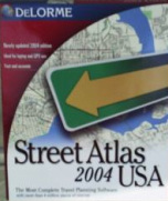
Title: Street Atlas USA 2004
Item: PC Mapping Software Publisher: DeLorme ISBN: 0-89933-703-1 Copyright 2003 Type: Interactive mapping software covering the entire USA. Includes: GPS connection and capable routing functionality. Includes every trail we used on this trip and more. I’ve used the Delorme Street Atlas USA product since about version 3 in 1997, and they keep making it better. |
 |
|
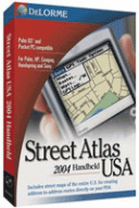
Title: Street Atlas USA 2004 Handheld
Item: PDA Mapping Software Publisher: DeLorme Copyright 2003 Type: Interactive mapping software that runs on a Palm handheld. Download selected maps from Street Atlas USA on the PC to the Palm version. Works with GPS to show current location, direction, elevation, etc on colored PDA maps. Cool software, especially working with a Palm compatible GPS to let you know right where you are. Can’t exactly replace a good paper map though. Of course a paper map can’t let you know where you are or which direction you’re headed. |
 |